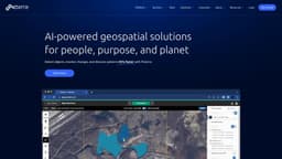
Picterra
AI-powered geospatial solutions for people, purpose & planet.
AIgeospatialsatellite imagery
Introduction
Picterra is a software platform for the training, deployment, and management of machine learning models powering geospatial apps and business services. It provides AI-powered geospatial solutions for detecting objects, monitoring changes, and discovering patterns in satellite, drone, and aerial imagery 95% faster.
Key Features
AI-powered geospatial solutions
Training, deployment, and management of machine learning models
Detection of objects, monitoring of changes, and discovery of patterns in satellite, drone, and aerial imagery
Cloud-native platform for optimizing geospatial workflows and driving sustainable action
Imagery sourcing and processing
Detector training support
Change detection, tracking, and monitoring
Dashboard and results customization
Frequently Asked Questions
What is Picterra?
How to use Picterra?
What industries can benefit from Picterra's geospatial AI solutions?
What are the core features of Picterra's platform?
What can Picterra help me achieve in terms of efficiency and productivity?
Similar Tools
Gallabox
Elevate your business communication with our No-code WhatsApp automation tool. Streamline processes and engage customers effortlessly.

LimeChat
Revolutionize your e-commerce business with our AI-powered platform that offers support and marketing through WhatsApp. Boost sales and engagement now!
Gethookd
Revolutionize your ad creation and performance with our AI platform. Optimize your ads like never before for maximum results.
Use Cases
- Forestry and carbon markets
- Agriculture and regenerative farming
- Mining and quarries
- Infrastructure
- FMCG and commodities
How to Use
Picterra's cloud-native AI platform allows users to optimize geospatial workflows, detect objects faster, and drive sustainable action. The platform provides tools for imagery sourcing and processing, detector training support, change detection, tracking, and monitoring, as well as dashboard and results customization.